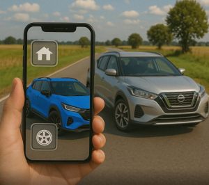
Apps to view your home and city via satellite
Apps to View Your Home and City via Satellite (Free and in High Quality)
Seeing your home from space is no longer the stuff of movies! With the evolution of satellite maps, it is now possible to view any location in the world in impressive detail — all directly from your cell phone. In this article, we have gathered the best apps to see your home and city by satellite, with real-time options, 3D features and extra functionalities that will surprise you.
Advantages
High Resolution View
See streets, houses, tourist attractions and natural landscapes in great detail, straight from the satellite.
Near Real-Time Monitoring
Keep up with changes in weather, traffic, or the environment with frequent updates.
Free and Worldwide Usage
Apps work globally, without country restrictions, and with free access to maps.
Extra Features
Measurement tools, image history and 3D maps are among the available features.
Best Apps to View Your Home and City via Satellite
Google Earth
Availability: Android, iOS, Web
Features: 3D visualization, virtual tours, historical visualization, 360° photos.
Differentials: Allows you to view any place in the world with satellite images and create your own maps.
Google Maps (Satellite Mode)
Availability: Android, iOS, Web
Features: GPS navigation, real-time traffic, Street View, detailed satellite mode.
Differentials: Combines navigation with satellite imagery, ideal for everyday use and local explorations.
NASA Worldview
Availability: Web
Features: Near real-time visualization of global phenomena, layers of meteorological, environmental and atmospheric data.
Differentials: Powered by NASA data, great for anyone looking to track climate and environmental changes.
Zoom Earth
Availability: Web
Features: Near real-time imagery, hurricane tracking, global weather, radar and satellite.
Differentials: Lightweight interface, constantly updated and great for viewing live events.
Here WeGo
Availability: Android, iOS, Web
Features: Offline navigation, satellite maps, live traffic, public transport.
Differentials: Ideal for travel and regions with poor internet connection.
Live Earth Map - Satellite
Availability: Android, iOS
Features: Satellite view, 3D map, real-time location, interactive maps.
Differentials: Good for virtual tours and locating homes and tourist sites with stunning visual detail.
EarthCam
Availability: Android, iOS, Web
Features: Live cameras around the world, viewing cities, attractions and beaches.
Differentials: Combines satellite view with real cameras streaming live.
SkyMap
Availability: Android
Features: Viewing the sky, locating stars, planets and artificial satellites.
Differentials: Ideal for astronomy, but also allows you to see the Earth from a unique perspective.
Interesting Extra Features
- 3D Mode: Some apps like Google Earth offer three-dimensional maps of buildings and terrain.
- Image History: See how a region has changed over the years with old imagery data.
- Climate Integration: Apps like Zoom Earth and Worldview display storms and weather phenomena in real time.
- Distance Meter: Useful tool for calculating areas or distances between points in satellite view.
- Interactive Maps: Many apps allow you to add markers, routes, and custom notes.
Common Care or Mistakes
- Wait for live images: Most apps show images a few hours or days late. Few offer live data.
- Blindly trust the data: Not all maps are 100% up to date, especially in rural or remote areas.
- Over zoom: Some apps distort the image when zoomed in too much, making it difficult to view.
- Fake apps: Avoid downloading apps with generic names that promise to “see your home live” without reliable sources.
Interesting Alternatives
- Apple Maps: For iPhone users, it also offers satellite views and detailed maps.
- Bing Maps: Microsoft platform with sharp images and intuitive interface.
- MapQuest: Offers maps and satellite images, with a focus on navigation and alternative routes.
- OpenStreetMap + Satellite: Collaborative platform with integrated satellite layers.
- Weather Apps: Like Windy or Clime, which use satellite images for weather forecasting.
Frequently Asked Questions (FAQ)
Most offer images with a delay of a few hours or days. Live camera apps are the closest to "real time."
Yes, all the apps listed are from trusted companies and use public satellite and map data.
Yes, except for apps like Here WeGo, which allow you to download maps for offline use.
Google Earth and Zoom Earth offer great features for free without requiring a premium subscription.
Yes, they are all global and work in most countries, except for specific local restrictions.
Conclusion
Viewing your home, city or even other countries via satellite has never been easier. These global applications combine high technology with practicality so you can explore the world without leaving your seat. Try the recommended apps, share them with friends and save this site for future reference. Your next trip can start straight from the sky!