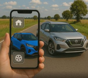
agricultural GPS application
O agricultural GPS application It is a tool that helps producers and rural workers visualize their location in the field, record routes, and organize activities. Using the cell phone's positioning, this type of application can facilitate the tracking of movements and offer a visual reference during different tasks in the agricultural routine.
Whether on small or large properties, a better understanding of the terrain contributes to more organized work. However, it's important to understand that cell phones have limitations in precision. Therefore, these apps should be used as support tools, considering the characteristics of the activity, signal reception conditions, and available resources.
How does an agricultural GPS app work?
The process begins with identifying the device's position using satellite signals. From this information, the application displays the location on a map and, depending on its functionalities, allows users to track routes, save points, and draw approximate boundaries of areas used in production.
Some tools also offer guide lines, route history, and surface area estimates. These features can aid in planning, but they don't necessarily have the precision required for mechanized operations. An app installed on a cell phone is not, by itself, equivalent to a professional agricultural autopilot system.
Advantages of Applications
Better guidance within the property.
Visualizing the location makes it easier to identify paths, access points, and landmarks. This can be useful in large or unfamiliar terrains, helping the operator understand their position and plan movements between different parts of the property.
Record of routes taken
When the app provides route recording, the user can see where they've been. This history helps document activities and organize visits, inspections, and trips. The quality of the record depends on the continuity and accuracy of the location.
Area estimation for planning
Drawing or perimeter marking tools can provide an estimate of the extent of a plot of land. This information serves as an initial reference for organizing tasks. However, measurements made with a cell phone do not replace technical surveys when precision or documentary validity is required.
Marking important points
Documenting locations such as gates, water troughs, storage areas, and sections with obstacles facilitates future reference. Depending on available resources, it is also possible to add notes. Thus, information that previously depended solely on memory becomes part of an organized record of the property's routine.
Support for the organization of activities.
Consulting maps and routes helps to distribute tasks and define the sequence of visits to the plots. This planning can avoid unnecessary travel. The results, however, depend on the updating of records, the terrain conditions, and how the tool is used.
Easy access via mobile phone.
Using a device already in place makes it easier to experiment with location features in the field. However, it's still necessary to check compatibility, battery consumption, and device protection, especially in environments with dust, heat, vibration, or humidity.
How to choose and use the tool
Before installing, define your needs: checking locations, recording routes, or estimating areas. Then, check which functions are included, if there are any charges, and how the data can be exported. It's also worth checking if the application allows you to download maps for offline viewing.
Test the tool in a known area before incorporating it into your work. Observe if the location fluctuates and compare the records with reliable references. During machine operation, configure the application with the vehicle stationary. and pay attention to driving and the surrounding conditions.
Frequently Asked Questions
The phone can receive positioning signals without internet access. However, viewing maps, syncing records, or accessing certain functions may require a connection. Offline functionality depends on the application and, in some cases, on downloading maps beforehand.
No. Accuracy varies depending on the device, sky visibility, and reception conditions. Trees, buildings, and other obstacles can interfere with positioning. Activities requiring high precision need appropriate equipment and solutions.
A standard mobile app is no substitute for autopilot. Such systems require compatible components, machine integration, and specific positioning and control capabilities. Lines displayed on the screen are merely visual references when this integration is lacking.
Yes. Small properties can also utilize location, point marking, and route tracking features. The usefulness depends on the tasks performed. Ideally, start with a specific need and evaluate whether the tool facilitates daily work.